


Revolutionizing Asset-Intensive Sectors: Virtual Plant Technologies' Aerial Photogrammetry for Enhanced Digital Twin Projects
Introducing Virtual Plant Technologies' Aerial Photogrammetry services, a powerful solution for capturing high-resolution aerial imagery and transforming it into precise 3D models. With our expertise in aerial data acquisition and advanced photogrammetric techniques, we offer an invaluable resource for asset-intensive sectors looking to enhance their digital twin projects.
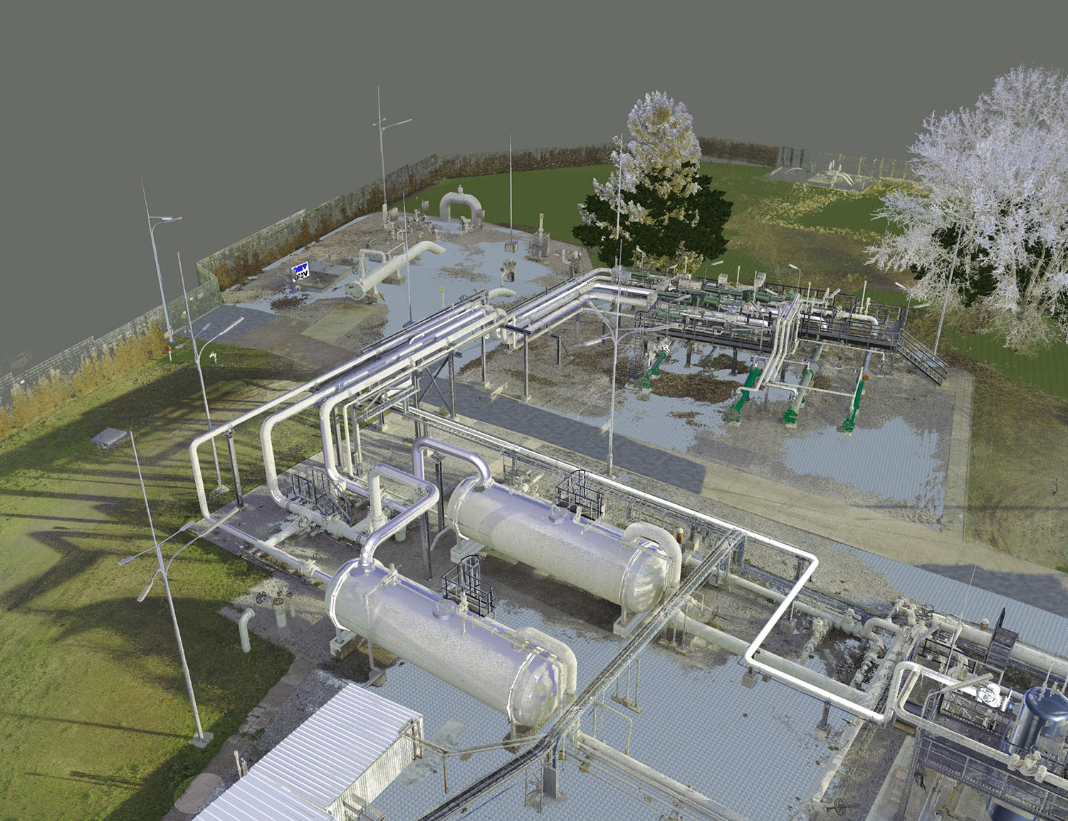
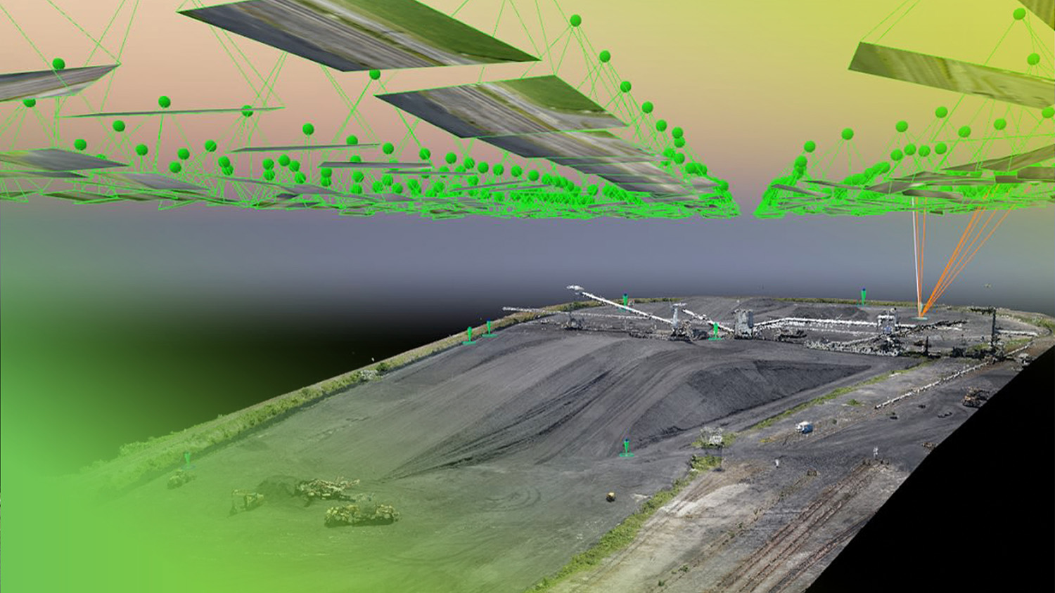
Aerial Photogrammetry plays a significant role in generating accurate and detailed representations of large-scale environments, infrastructure, and assets. By leveraging state-of-the-art unmanned aerial vehicles (UAVs) equipped with cutting-edge cameras and sensors, we can capture high-resolution imagery from multiple angles and heights, ensuring comprehensive coverage of your assets.
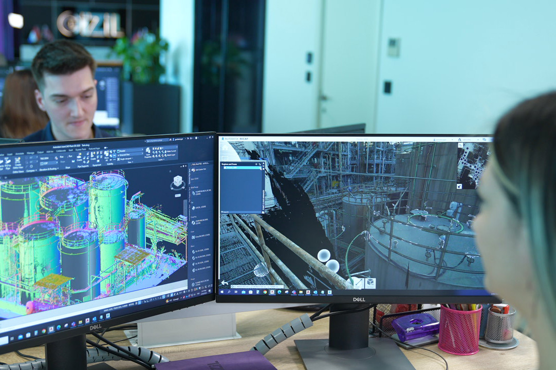
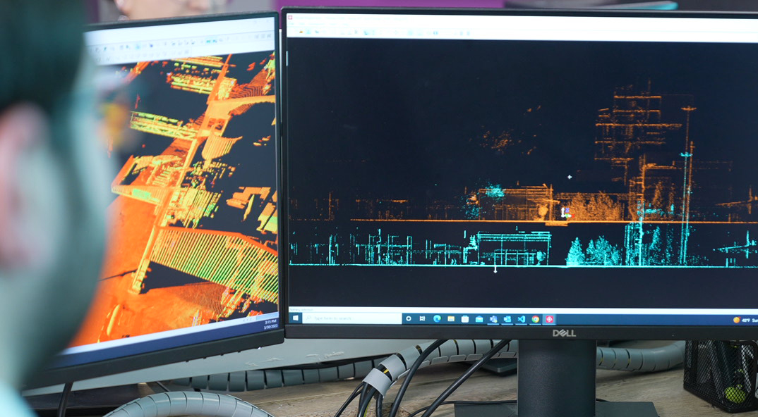
Our skilled team of photogrammetry experts utilizes advanced software and algorithms to process the collected aerial imagery, generating highly accurate 3D models. These models contain detailed geometric information, allowing for precise measurements, volumetric analysis, and spatial data integration.
The contribution of Aerial Photogrammetry to digital twin projects in asset-intensive sectors is immense. By incorporating aerial data into digital twin ecosystems, organizations gain a holistic view of their assets, enabling effective asset management, maintenance planning, and operational decision-making.
Aerial Photogrammetry provides several key benefits in asset-intensive industries. Firstly, it enables the creation of accurate and up-to-date asset inventories, aiding in asset tracking, condition assessment, and compliance management. By regularly capturing aerial imagery and updating the digital twin, organizations can monitor asset health, identify potential issues, and proactively address maintenance needs.

Furthermore, Aerial Photogrammetry enhances the visualization and simulation capabilities of digital twins. The high-resolution 3D models derived from aerial imagery facilitate immersive virtual experiences and accurate scenario simulations. This enables organizations to optimize operations, test different scenarios, and evaluate the impact of changes before implementing them in the physical environment.
Virtual Plant Technologies combines its expertise in Aerial Photogrammetry with industry-specific knowledge to deliver tailored solutions for asset-intensive sectors such as energy, infrastructure, and manufacturing. Our commitment to utilizing the latest technology ensures that we provide accurate, reliable, and actionable data for your digital twin projects.
By partnering with Virtual Plant Technologies for Aerial Photogrammetry, you gain access to a comprehensive suite of services, including flight planning, data acquisition, processing, and integration with your digital twin ecosystem. Our team works closely with clients to understand their specific requirements and deliver solutions that drive operational efficiency, cost savings, and informed decision-making.

Elevate your digital twin projects to new heights with Virtual Plant Technologies' Aerial Photogrammetry services. Contact us today to explore how our expertise can revolutionize your asset management practices and unlock the full potential of your digital twin initiatives.
Learn more about our Aerial Photogrammetry services